Menu


Two sections on the same Omokoroa street can carry completely different rules. One is a straight run at a building consent. The other needs a resource consent, a geotechnical report and a floor level 500 millimetres above a mapped flood line. Four layers sit over every lot on this peninsula: the district plan, the hazard maps, the ground and what it does with stormwater, and the covenants on the title, which are not council rules at all.
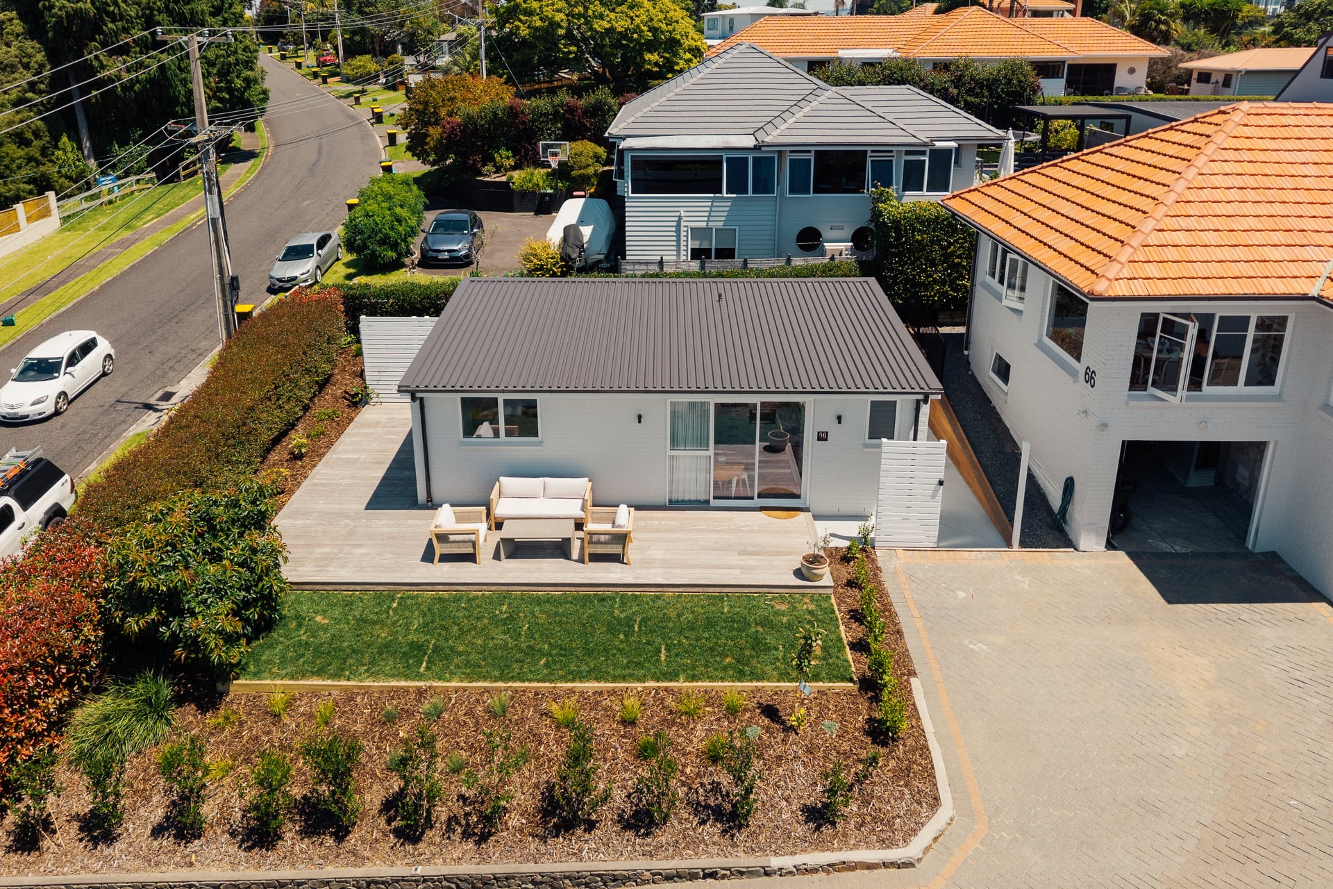
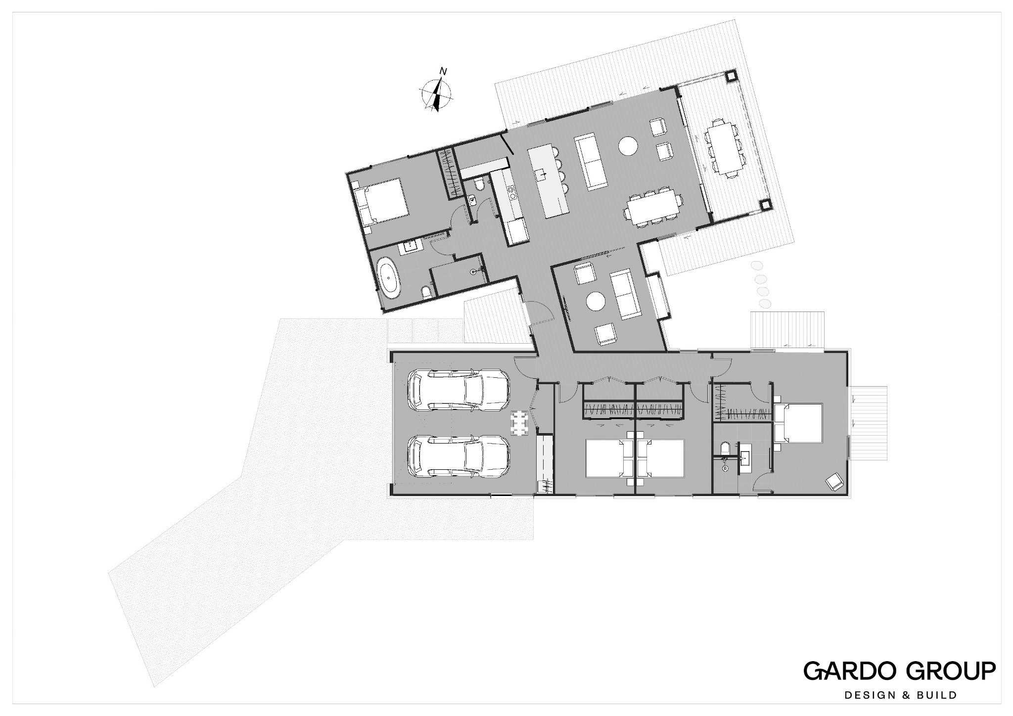
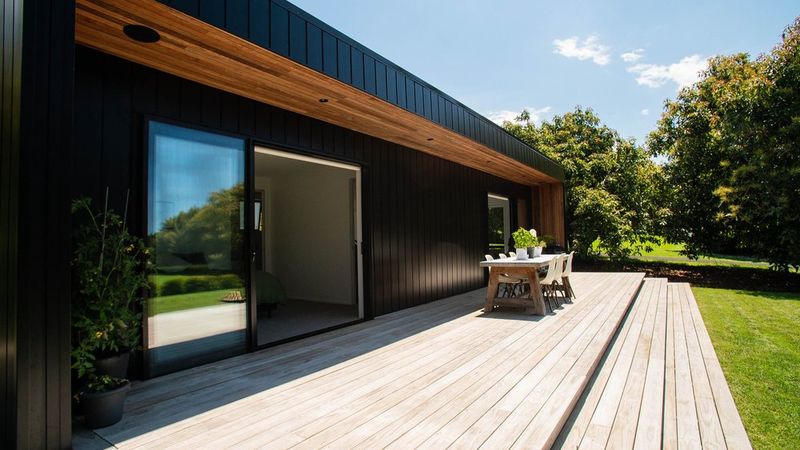
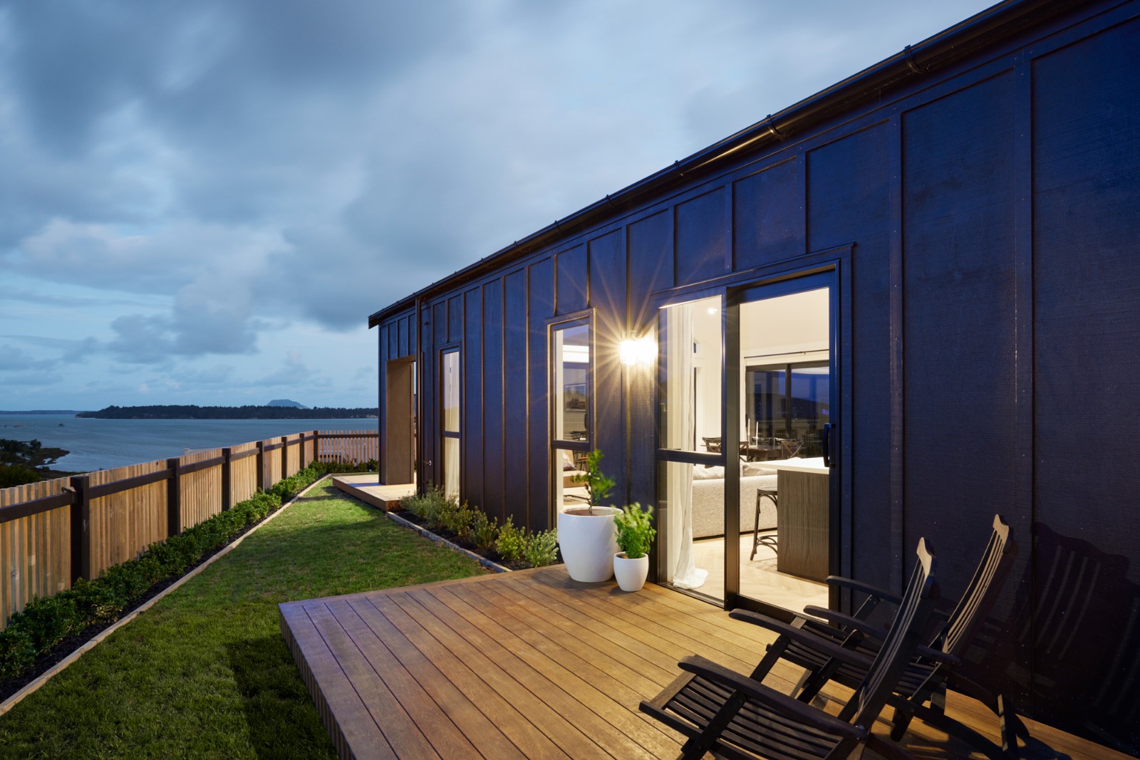
Omokoroa is where we built The 15 degree House, 180 square metres of two gable pavilions set at a 15 degree offset on a sloping site, and our showcase home on the coastal slope, where the living wing cantilevers over the ground floor and the garage is anchored into the hill. Here is what we check before anyone draws a line.
Omokoroa runs under Plan Change 92, which brought the Medium Density Residential Standards into the district plan here and in Te Puke. The density standards have had legal effect since 20 August 2022. The plan became operative on 21 March 2024, with the parts decided by the Minister operative from 27 May 2024. PC92 ran under the Intensification Streamlined Planning Process, so there was no Environment Court appeal right on the Minister's decisions. These rules are settled.
Up to three homes on a site is a permitted activity, provided all nine density standards are met and no qualifying matter applies. A qualifying matter is an ecological feature, a heritage feature or a natural hazard such as flooding, and it takes away permitted status and sends you to a resource consent. On this peninsula the hazard layers are the ones to check first, because Omokoroa carries both mapped flooding and mapped land instability.
PC92 also layered Omokoroa specific rules on top of the nine: retaining wall and fence heights, earthworks controls, garage and driveway dominance, an impervious surface limit to hold stormwater runoff down, minimum density in new development areas, and housing variety requirements.
The medium density rules have not been repealed here, whatever you have read. The 2025 amendment that let a council withdraw the MDRS was written for Auckland Council and Christchurch City Council. Auckland used it, partially withdrawing Plan Change 78 from 9 October 2025. No other council was given that ability. Western Bay's notified plan changes as at September 2026 are Plan Change 96 and a withdrawn private plan change at Pongakawa, and neither is an MDRS removal. The two bills replacing the RMA were introduced on 9 December 2025 and the new system is signalled to go live in 2027, so the MDRS is intended to be replaced under that programme rather than before it.
So these are the numbers.
Height is 11 metres, three storeys, with half the roof allowed a further metre where the entire roof slopes at 15 degrees or more. Height in relation to boundary is 4 metres plus a 60 degree recession plane. Setbacks are 1.5 metres to the front, 1 metre to the sides and rear, with the rear yard excluded on corner sites. Building coverage tops out at 50 per cent of the site. Outdoor living space is at least 20 square metres per unit at ground level, or 8 square metres above ground level. At least 20 per cent of the site has to be planted in plants, grass or trees, and that can be provided communally across a development. At least 20 per cent of the street facing facade has to be glazed, which council reads as the facade of the house rather than the garage. Outlook space is 4 metres by 4 metres off the principal living room and 1 metre by 1 metre off every other habitable room.
In the last stage of development south of the railway, some areas allow 22 metres, six storeys, and building coverage up to 60 per cent. Those areas sit next to the future town centre, the school, the reserves and the open space network.
The recession plane and the outlook rule are the two that reshape a plan, and they do it long before anyone picks cladding. A 4 metre by 4 metre outlook off the principal living room decides where the living room goes on a tight lot, and the recession plane decides how much of the upper floor survives once you are close to a boundary.
Omokoroa is the only place in the district where the district plan flood maps are the current ones. They were produced in 2020 and model a 1 per cent annual exceedance probability event, the 1 in 100 year event, with climate change out to 2130. Put a habitable building in a mapped floodable area and you need a resource consent and a floor level 500 millimetres above the identified flood level for that property.
An old number does not hold. A minimum floor level written into an earlier resource consent or a consent notice is not locked in. Council uses the most up to date flood information at building consent stage, and says the levels are likely to have changed.
Coastal inundation and erosion around Tauranga Harbour are mapped outside the district plan. The harbour inundation work is NIWA's 2019 modelling of a 1 per cent AEP storm surge with sea level rise 100 years out. The Omokoroa erosion lines come from Tonkin and Taylor's 2019 assessment, which deliberately ignores existing seawalls and revetments because there is no certainty they will be maintained over 50 to 100 years. Because neither set of maps sits in the district plan, council cannot require a resource consent on the strength of them alone, but it does impose controls through the building consent. Both still go onto the property file and into the LIM, so read them before you buy rather than after.
Land instability is in the district plan. Omokoroa is one of the mapped land stability areas, split into Stability Area General, land possibly subject to instability, and Stability Area Landslip, land vulnerable to long term landslip risk. Inside either one, a house, a shed or a garage needs a resource consent and a geotechnical report, and so do earthworks and minor structures like a carport, a deck, a pool or a tank. That report is what determines whether the land is suitable to build on and what the foundations have to be. An approved building site from an earlier subdivision does not override newer hazard information, and council says its own GIS hazard mapping is not complete and that many sites will be affected by hazards it does not show.
Western Bay and Tauranga City jointly require geotechnical engineers and engineering geologists on complex sites to hold local accreditation on top of Engineering New Zealand registration. A report on a steep or unstable slope, on liquefiable ground, or on soft or settlement prone soils has to be written or reviewed and approved by a Category 1 geo professional.
A LIM carries the natural hazard information council holds, the public and private stormwater and drainage, the consents, notices and orders, and the district plan zoning. It does not carry private covenants, Bay of Plenty Regional Council information, the record of title, building plans, or anything at all about the neighbouring properties, and nobody visits the site to prepare it. Western Bay publishes an electronic LIM fee of $388 standard on ten working days, or $554 urgent on four, both GST inclusive.
The Western Bay Development Code stormwater standard, DS5, is still the September 2009 version on the council website. Under it, soakholes cannot be used for stormwater disposal without council approval, and every soakage system has to be specifically designed. Council's own words are that soakhole and soakpit disposal has contributed to land instability and to groundwater seepage nuisance in the elevated urban areas around the Tauranga Harbour perimeter.
For infill in an existing urban area, soakage is only consented where there is no other route: no public piped network, no piped or open drain, no kerb connection, no watercourse alongside. Where soakage is used, council wants a site investigation by a Chartered Professional Engineer, in some cases a Category 1 or 2 geotechnical engineer, a soakage rate reduction factor of generally 0.5, and certification that there is no adverse land stability, seepage or overland flow effect on other land. It wants confirmed overflow flowpaths, storage volume, construction and access detail, and a long term maintenance regime. The soakhole has to sit above the static groundwater level in heavy rain conditions, stay clear of driveways and hardstand so it can be maintained, and have a removable lid, and its position goes to council before the code compliance certificate is issued.
In Stage 3 the bar goes up again. The Stage 3 stormwater catchment management plan says that given the history of landslides at Omokoroa, the approval process has to consider the effect of stormwater disposal on slope stability, and that detailed design has to address whether soakholes are appropriate at all, including the ones taking roof downpipes, and whether unlined bioretention devices are. Site specific soakage and geotechnical investigations are required to inform that. Maximum impervious surface limits apply in the Medium Density Residential and Rural Residential zones as a structure plan rule, and can be exceeded case by case where on site mitigation such as detention, or retention with non potable reuse, is provided. Another structure plan rule requires inert exterior materials, which rules out unpainted zinc and copper.
Under all of it is the ground. The soil column at Omokoroa runs Te Puna Ignimbrite at the bottom, then the Pahoia Tephra sequence, Hamilton Ash beds, and late Quaternary tephras on top. The sensitive silts in the Pahoia Tephras owe that sensitivity to halloysite, a clay mineral formed in weathered volcanic ash, and the sensitivity increases with depth. Heavy rain lifts pore water pressure, the material loses strength, and failure runs along those beds. That is why horizontal drains have been installed in cliffs around the peninsula to pull water pressure down, and it is why the geotechnical report comes before the floor plan on a sloping lot here.
Good ground under NZS 3604 means an ultimate bearing capacity of 300 kilopascals or greater, not loosened by excavation, not subject to significant seasonal moisture movement, not on a slope where instability could occur, and not organic or uncontrolled fill. Where a site does not meet that, the foundations become specific engineering design. Council and Bay of Plenty Regional Council are still working out which parts of Omokoroa are susceptible to landslide runout, and liquefaction mapping for the Stage 3 area is listed as still to be completed.
Covenants are private restrictions registered on the record of title. They sit alongside the council rules, they are enforced separately, and they do not appear on a LIM. They can be enforceable in gross, which means the development company holds the right to enforce them, not only the adjoining owners.
Across New Zealand, subdivision covenants commonly control construction materials and colour palettes, the height and design of the house, the garage and the fences, minimum floor area, visibility of utilities and clotheslines, where a caravan, boat or trailer can sit, the number of dwellings, and animals. A covenant can cap height well below the 11 metres the district plan allows, which is the one that catches people who have already designed to the zoning. That list is general New Zealand guidance rather than a description of any particular Omokoroa subdivision, so read your own set and read it early.
A second dwelling on a section you already own runs on a different track again. That is minor dwellings territory, and the granny flat rules post covers where the building consent exemption reaches and where it stops.
Stage 3 is the final development stage on the peninsula, the land between the railway line and State Highway 2. It carries residential zones, industrial land, a town centre, a school site, sports fields and a Natural Open Space Zone over the gully network, which PC92 created so the gullies can do the stormwater work and carry the walkways. It provides for around 2,300 homes.
Council expects the peninsula to be fully developed and home to about 12,000 residents by 2050, and says Omokoroa has less infill opportunity, so most of that will come off greenfield land. The upgraded State Highway 2 and Omokoroa Road intersection opened in August 2026 with the first stage of the Omokoroa Road urbanisation, including four laning between State Highway 2 and Prole Road. Stage 2 of that urbanisation is due to finish in October 2026. The Western Bay of Plenty City and Regional Deal, signed on 14 May 2026, puts Omokoroa in the Northern Corridor alongside Katikati.
For someone building, that is a design question more than a market one. The paddock next to your section can hold three houses at 11 metres under the same standards you are working to. Set your outlook, your glazing and your boundary treatment against what a neighbour is allowed to build, not against the view on the day you walk the site.
Order the LIM and the record of title before you commit to a section, and read the covenants alongside the hazard layers. Between them they will tell you more about what the house can be than any floor plan will.
Then get us out there. Chris runs the build and Hannah is our architectural designer, and the two of them come to the first site meeting together, so the design, the consent pathway and the pricing get worked out by the same people standing on your ground. We will walk the slope with you and tell you what those four layers mean for the house you have in mind. That is how every new build and design and build job starts, in Omokoroa and across the wider Western Bay.
Email Chris at chris@gardogroup.co.nz or use the contact page. Our projects are there to look through, and the cost of building in Omokoroa post covers the money side.